Every locate you've ever done - on one searchable map.
Geo Mapper is the ticket location database. Years of finished paperwork, imported automatically and indexed by road, intersection, city, contractor, work type and station code - so before anyone drives out, they can see what's already been located there and pull up the drawing that proves it.
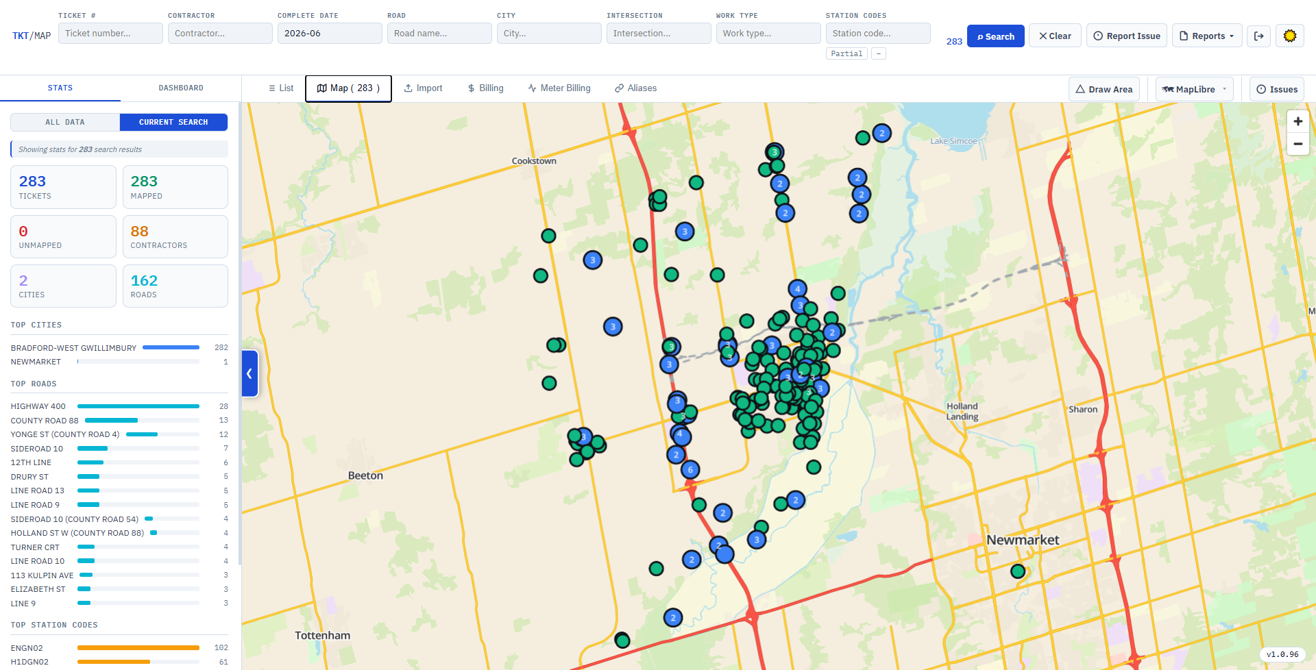
Drop the file in and this frame fills itself.
"Didn't we locate this corner last year?"
Somebody remembers the job. Nobody remembers the ticket number. The paperwork is in a folder on a share drive named after a date, and finding it costs twenty minutes - so most of the time nobody looks, and the whole locate gets done again from scratch.
Type the road. There's the job.
Search "Maple St" and every ticket that ever touched it comes back - mapped, dated, with the contractor, the station codes and the original drawing one click away. The answer takes seconds, so people actually check.
Eight ways into the same history.
Every field narrows the same query, and every field autocompletes from the live database - you're picking from roads and contractors that genuinely exist, not guessing at spellings.
Where & who
Road name, nearest intersection, city, contractor, work type, completion date - combine any of them. Autocomplete lists are cached so they stay instant on a database this size.
Station codes, partial or exact
Search a full station code, or flip to partial matching to catch every variant and suffix under a code family - the way the codes actually get written in the field.
Road name aliases
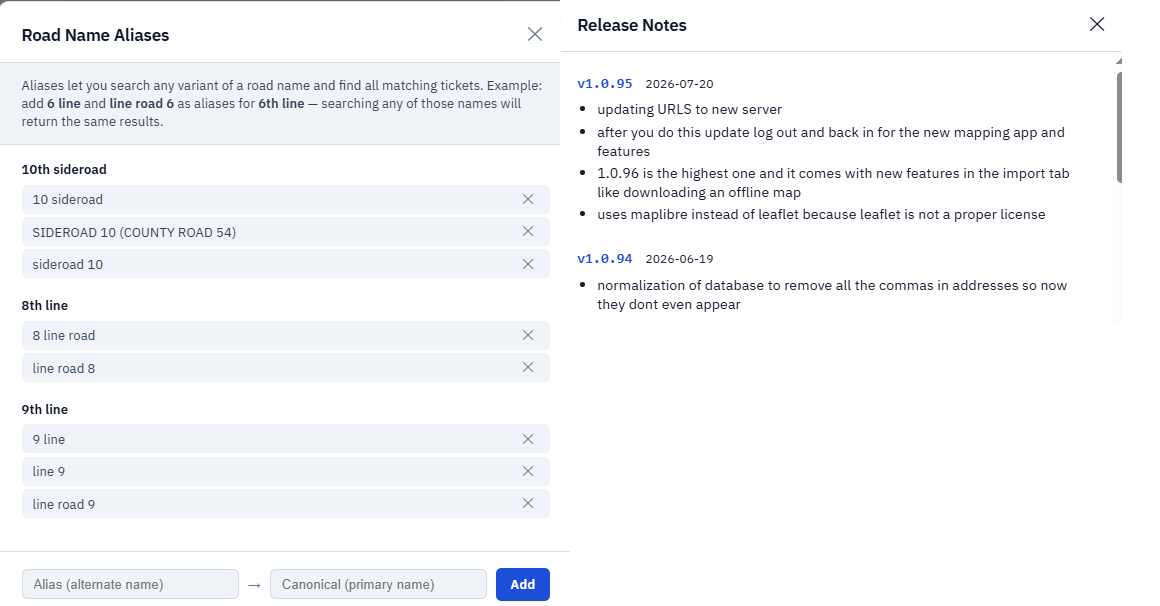
"Hwy 6", "Highway 6" and "Main St N" are the same stretch of road. An alias table teaches the database that once, and every search after it expands automatically.
The list and the map are one query
Results fill the table and drop pins at the same time. Narrow the search and both shrink together; pan the map and you can search by what's in view instead.
Take the answer with you
Any result set exports to CSV or a formatted Excel workbook in one click - for a report, a claim, or handing a contractor the history of their own corridor.
Draw a box around the neighbourhood. Get its whole history.
Every mapped ticket is a pin on a full vector basemap that runs off a local tile archive - no internet, no tile bill, no blank grey squares in a basement or out past cell coverage.
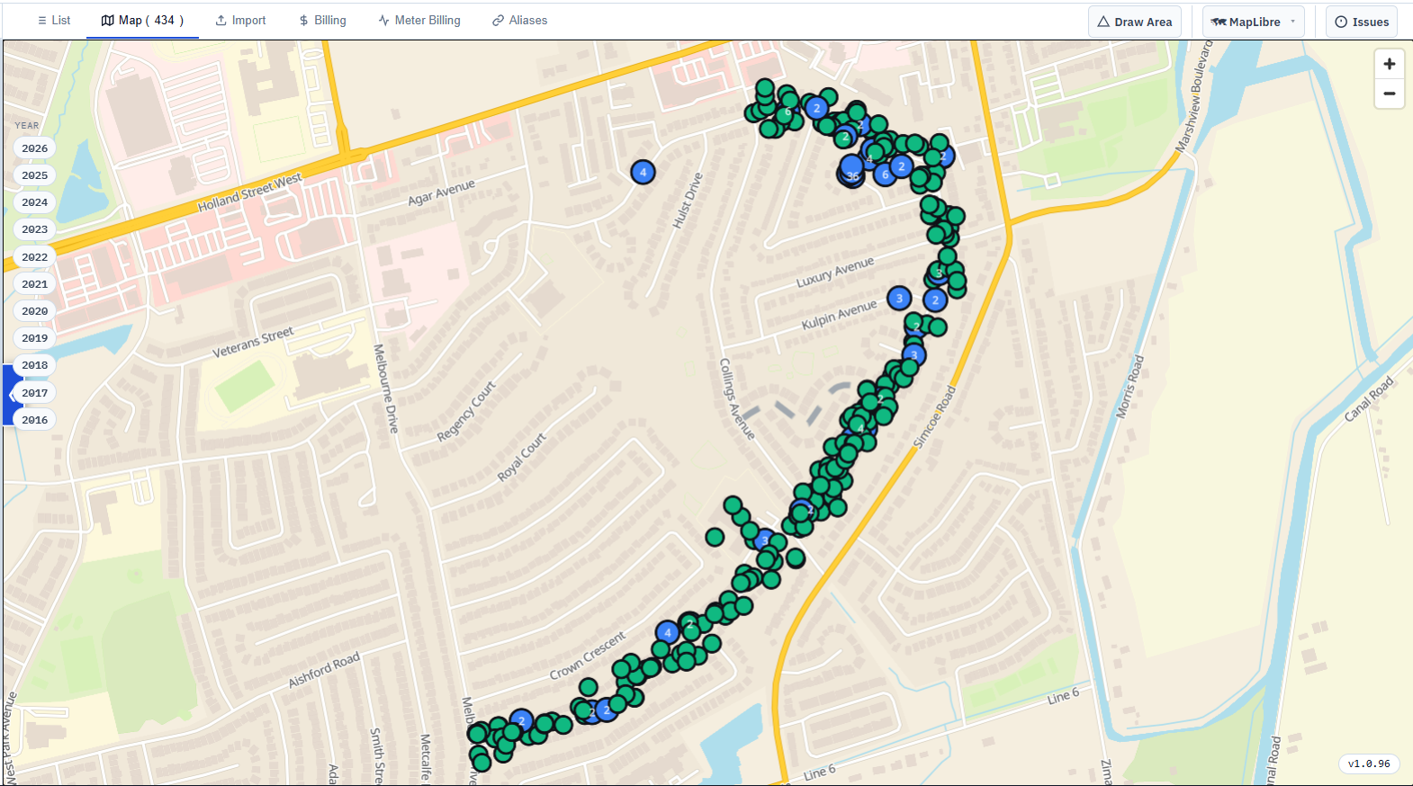
Search by viewport, not by name.
Some jobs are easier to point at than to describe. Pan and zoom to the area you care about and the bounding box becomes the search - every ticket inside the frame, however it was written up.
- Click a pin for the ticket - contractor, dates, work type, station codes, drawings.
- Mapped vs. unmapped counts are tracked, so you know what still needs coordinates.
- Download the tile archive once, then check for map updates and apply them in place.
- Same map engine as the field app - one basemap standard across the suite.

The same database, answering management's questions.
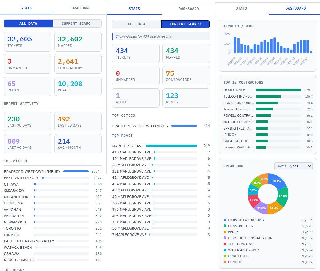
Flip from the results list to the dashboard and the history turns into numbers - over everything you've ever done, or over just the search you're looking at right now.
What's in there
Total tickets, how many are mapped and unmapped, and how many distinct contractors, cities and roads the archive covers.
Volume over time
Tickets per month with a running average, plus recent activity - the shape of your season, and whether this one is heavier than last.
Where the work concentrates
Top cities, top roads and top station codes, plus full breakdowns by work type, contractor, city and code - with one-click copy of any list.
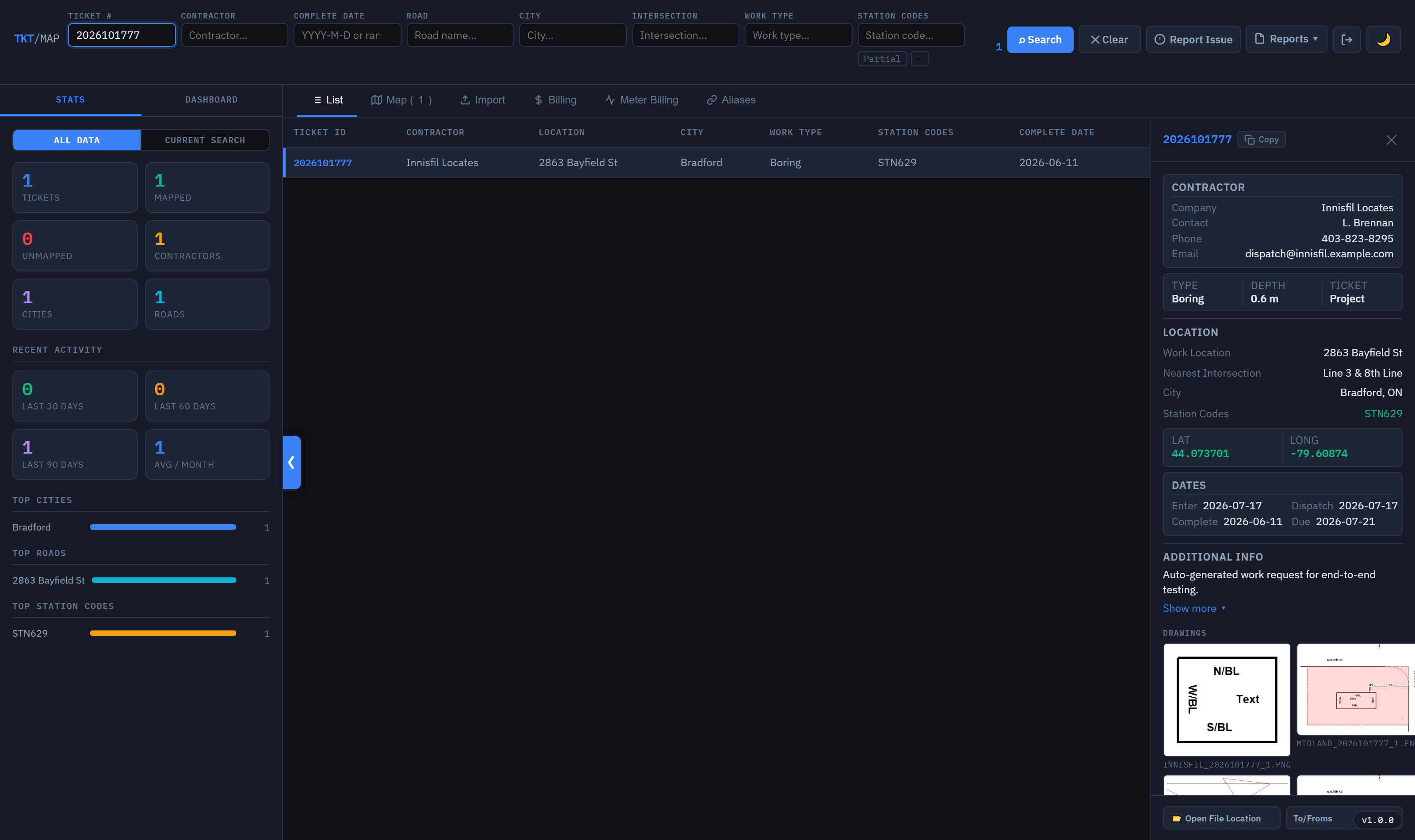
The proof, attached to the record.
A ticket in the list isn't just a row - it carries the field drawings that were done on the day. Geo Mapper renders them straight from the saved drawing data rather than a flattened export, so the sketch you pull up in three years is the sketch that was drawn.
- Thumbnails in the results - see at a glance which tickets actually have a drawing.
- Rendered from source, using the same shape and symbol definitions as DrawPyCS.
- Generate a JPEG onto your own page templates when someone needs a copy to send.
- Open the original file on disk if you need the raw paperwork itself.
Nobody has to feed it.
Point Geo Mapper at the folder where finished paperwork lands and it takes over: new files get copied, parsed, geocoded and indexed on their own, in the background, forever.
Files land
A background watcher scans the source folder on a schedule, copies anything new to a backup location, and queues it.
Read the ticket
Location, contractor, dates, work type and station codes are pulled out of the paperwork and written into the database with its drawings.
Catch the gaps
A reconcile pass re-walks the whole directory to pick up anything missed while the machine was off - with a running log of every scan.
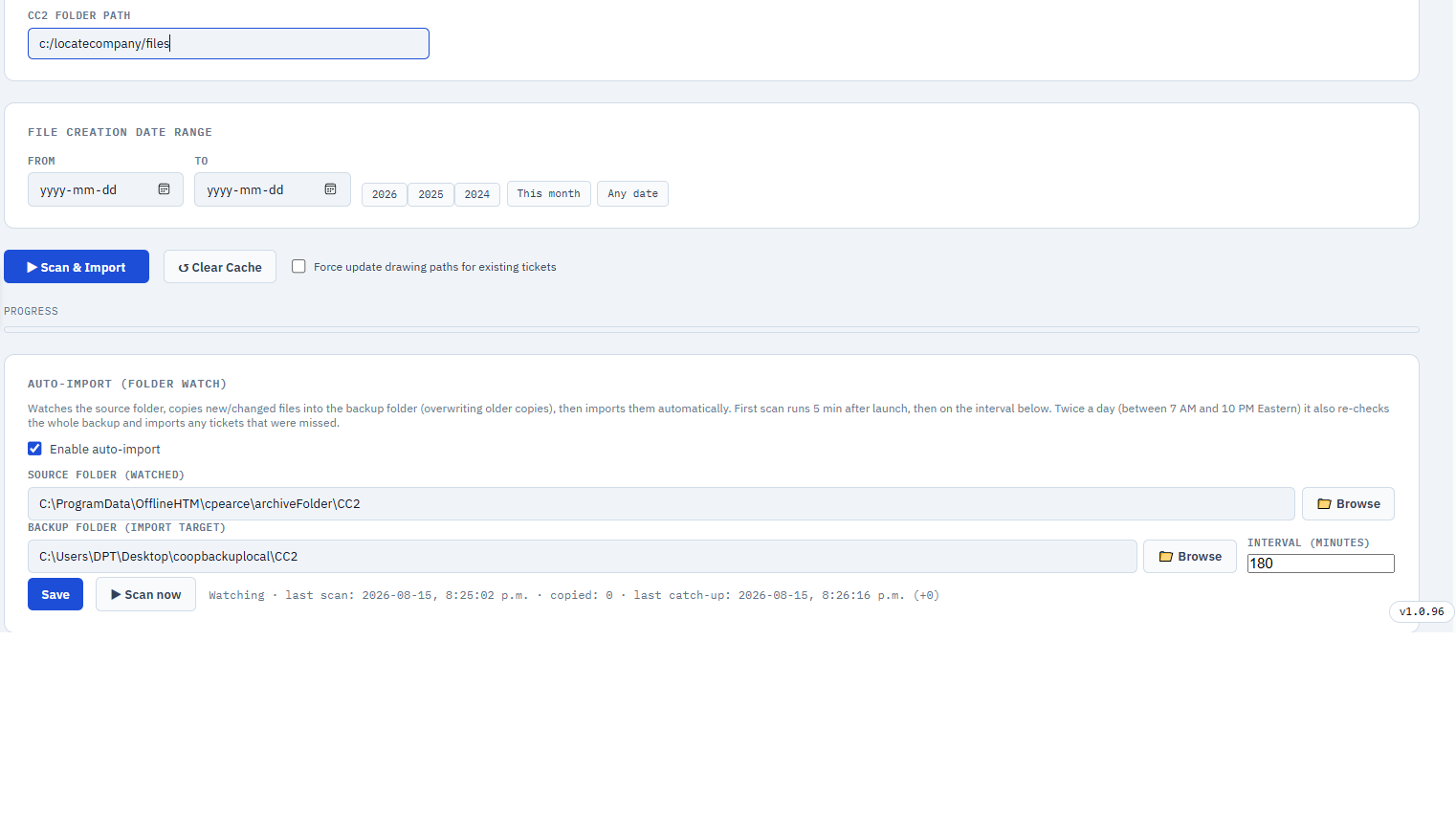
Backfill years in an afternoon.
The first run is the big one. Aim the importer at the archive, optionally bound it to a creation-date window, and watch imported / updated / failed / scanned tick up. Re-runs are safe - existing tickets are skipped unless you deliberately force a refresh.
- Date-range scoping - "just this month" or the whole share drive.
- Force-update drawings when a batch needs re-rendering, without touching the rest.
- Failures are counted and logged, not swallowed - you can see what didn't parse.
- Runs in-process - no separate server to babysit, no scheduled task to forget.
The odd jobs that used to be somebody's spreadsheet.
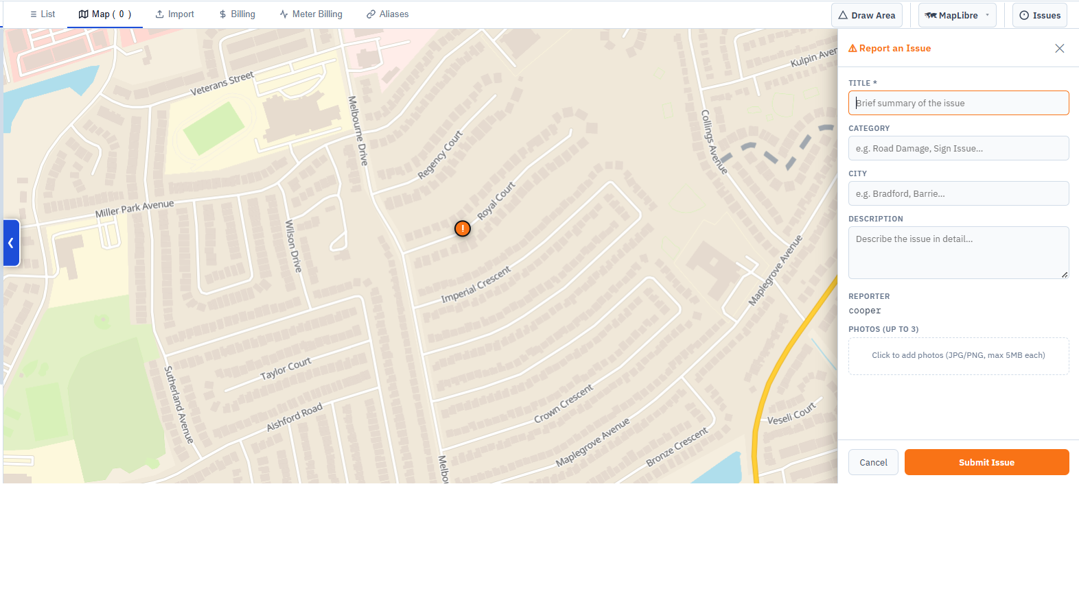
Field issue tracking with photos, road aliases and release notes - all in the same window as the search, because that's where people already are.
The memory behind the other three.
Field Ticket Manager runs today's work. Geo Mapper remembers all of it - and the two speak the same drawing format, the same station codes and the same basemap.
Completed work flows in
Tickets finished in Field Ticket Manager land in the watched folder and index themselves - no export step, no double entry.
Drawings stay readable
The same shape and symbol definitions that DrawPyCS draws with are what Geo Mapper renders with - an old sketch never becomes an unreadable blob.
One basemap standard
The same offline vector tile stack as the field app, so the map an office user sees is the map the crew sees - and neither needs a connection.
A desktop app with a web app's interface.
Geo Mapper ships as a single Windows executable. Inside, it starts its own local API and renders the UI in an embedded browser - so the interface is fast and modern, and there's still nothing to deploy, no server to run, and no data leaving the building.
Updates itself, quietly
The launcher checks a version manifest on start and offers the update in a dialog - so a fleet of office machines doesn't drift onto four different builds.
Signed in, and stays that way
Login is checked against the same account system as the rest of the suite, with a long-lived session so daily users aren't re-typing a password to look up a road.
See your own history, indexed.
Book a walkthrough and we'll import a slice of your finished paperwork, then search it in front of you - your roads, your contractors, your drawings.