Run the whole locate, from dispatch to done.
One package for utility locating crews: the office dispatches and tracks every ticket, the field draws code-accurate sketches on site, and it all syncs back - online when you have signal, fully offline when you don't. Field Ticket Manager for the paperwork, DrawPyCS for the drawing.
| Ticket | Location | Type | Status | Due |
|---|---|---|---|---|
| 2026-441702 | Maple St & 4th | Emergency | Overdue | Today |
| 2026-441688 | 120 Birch Cres | Routine | Dispatched | Jul 29 |
| 2026-441675 | Hwy 6 & Concession 4 | Design | Open | Jul 30 |
| 2026-441640 | 88 Elm Ave ◳ drawing | Routine | Complete | - |
| LOCAL-0007 | Yard hydrant tie-in | Local draft | Local | - |
Built to work together, not bolted together.
The manager, the drawing tool, the connection between office and field, and the archive of everything you've already done are one system. A sketch you draw belongs to a ticket; a ticket the office dispatches lands in your queue; a ticket you finish becomes history you can search.
Field Ticket Manager
Track every locate through open, dispatched, overdue and complete. Search, filter, print, and bill - with each ticket's forms, photos and drawing kept together.
Full breakdown ▶DrawPyCS
Sketch water, gas, power and comms in their APWA colors from a full symbol library - standalone, or docked right inside a ticket so the drawing saves with it.
Full breakdown ▶Dispatch & sync
The office assigns work over the web; crews pull their tickets, complete them with no signal, and everything uploads the moment they're back online.
Full breakdown ▶Geo Mapper
Years of finished locates, indexed by road, intersection, contractor and station code - searchable in seconds, plotted on an offline map, with the original drawing attached.
Full breakdown ▶Every ticket, tracked from the moment it lands.
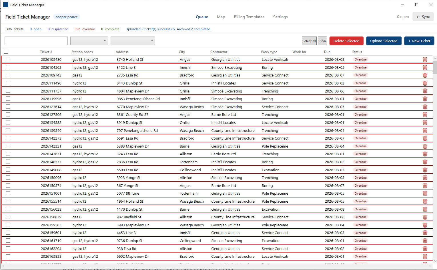
The queue is the home base: a fast, dense table of every locate you own, colored by status so what's overdue or unassigned reads at a glance.
Explore Field Ticket Manager ▶Status at a glance
Live counts for total, open, dispatched, overdue and complete - with color-coded pills on every row.
Search, filter & sort
Find any ticket by number or location; filter by status or work type; sort any column - the grid keeps your place.
Ticket paperwork
Primary, auxiliary and summary pages open per ticket, each in its own window - with photos, stickers and notes to excavators.
Billing templates
Reusable billing layouts keyed to contractor codes and employee numbers, so charges come out right on every ticket.
Print & export
Print-preview the whole ticket, print to any page, and hand off clean PDFs or images for the file.
Refresh & reschedule
Pull fresh paperwork before it expires, reschedule work, and get a clear heads-up when a completed ticket needs a redraw.
See the day on a map, and hand it out.
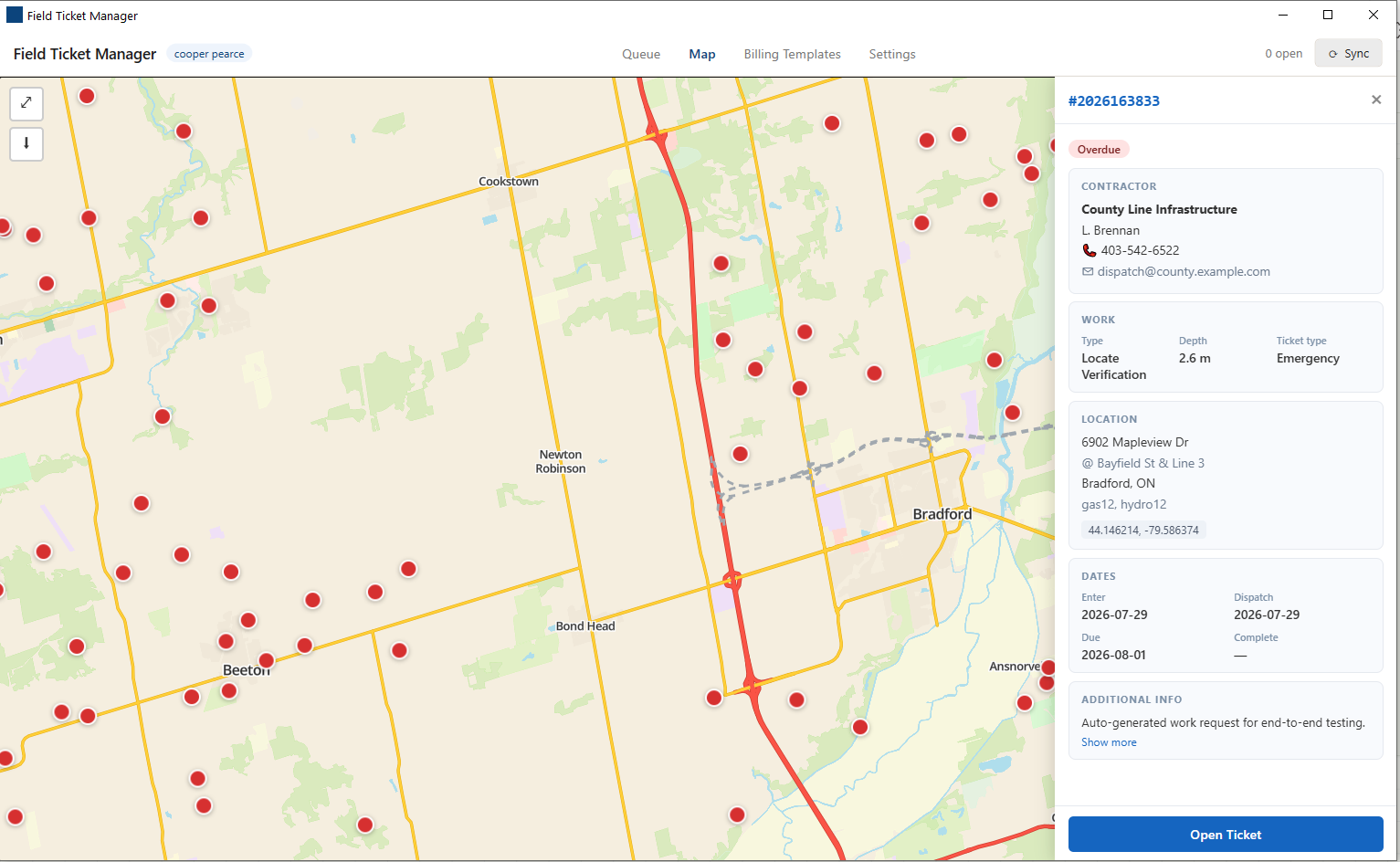
Every ticket with coordinates drops a pin on a full vector basemap. The office assigns work over the web - each crew's token pulls exactly the tickets meant for them - and privileged users can dispatch straight to any worker.
- Pins colored by status - spot the overdue jobs across town in one look.
- Tap a pin for the full detail drawer - contractor, work type, dates, location.
- Assign to a worker from the office and it appears in their queue on next sync.
Sketches that already speak your trade.
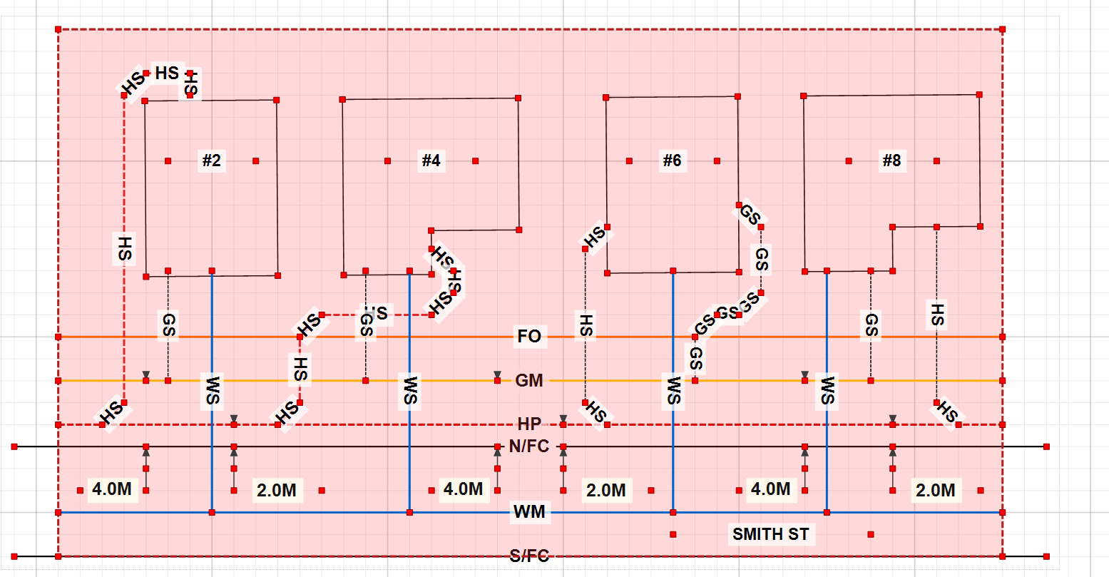
DrawPyCS is a drawing board scoped to one job: turning what's underground into a print anyone on the crew can read. 18 utility line tools, 30+ field symbols, layers you can toggle, snap, measure, undo - and it docks straight into a ticket so the sketch saves with it.
Explore DrawPyCS ▶Water
Gas & pressure mains
Electrical & power
Telecom, TV & fibre
Sewer
Site & annotation
Signal is optional. The work isn't.
The whole loop runs on the truck with no bars. Dispatch pulls when you have a connection; everything else - drawing, forms, photos, even the map - works fully offline and uploads later.
Dispatch over the web
Staff assign tickets to crews from anywhere. Each worker's token pulls exactly their jobs - no shared logins, no wrong tickets.
Complete it with no signal
Open the ticket, draw the locate, fill the forms, add photos. The vector map keeps working from cached tiles for any area you've panned - download a whole province for total coverage.
Sync back automatically
Photos route to the office view, drawing and form data back up as compact files, and the queue reflects it - with a clear alert if a finished ticket needs a redraw.
The work you finished is the answer to the next job.
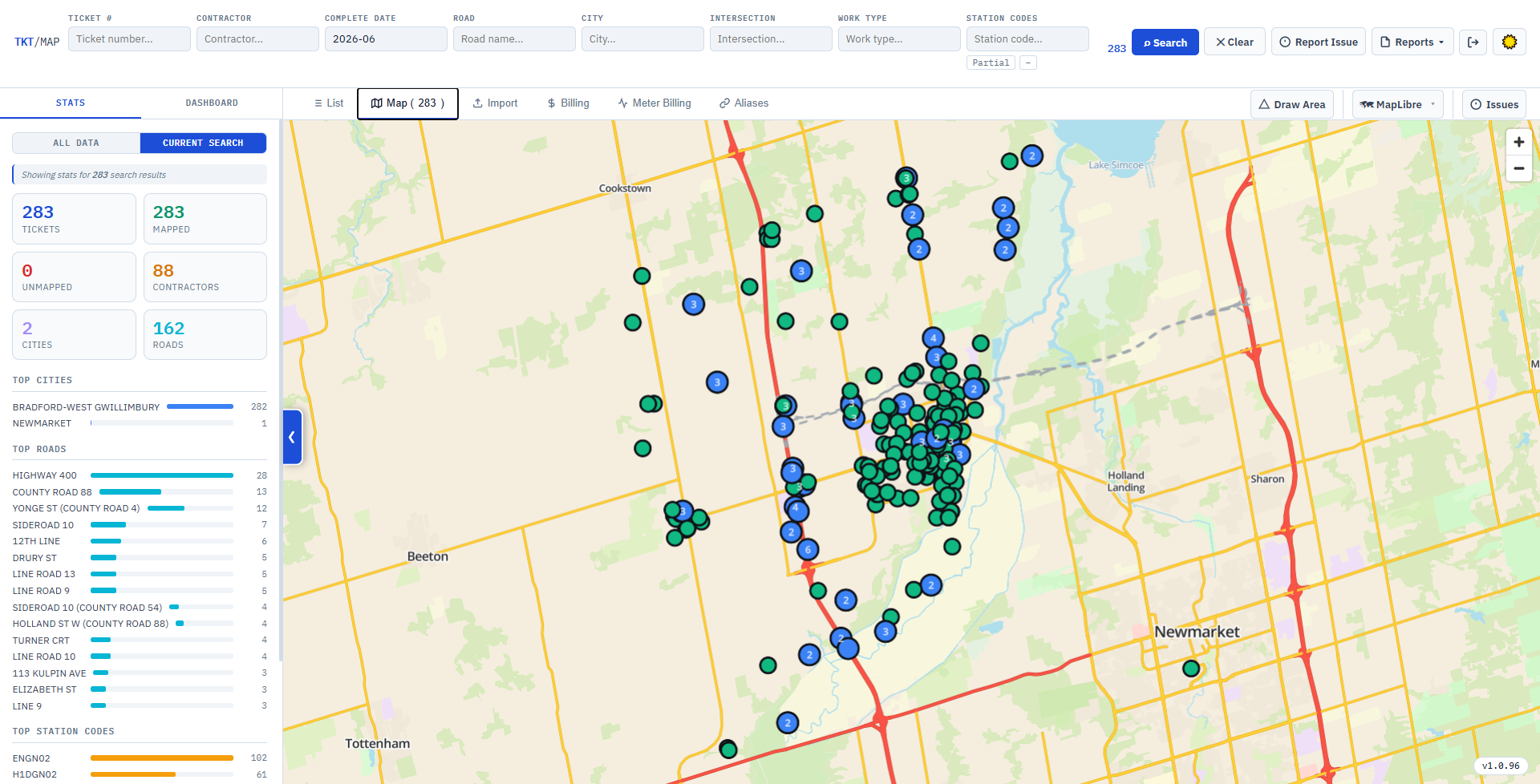
Every completed locate imports itself into a searchable archive. Type a road, a contractor or a station code - or just draw a box on the map - and see what's already been located there, with the original drawing attached.
Explore Geo Mapper ▶Search years in seconds
Road, intersection, city, contractor, work type, date and station code - combined, autocompleted, and expanded through your own road-name aliases.
Mapped, and offline
Results plot as pins on the same offline vector basemap the crews use. Pan to an area and search by what's in view - no connection needed.
Indexes itself
A background watcher picks up finished paperwork from a folder, parses it, renders the drawings and files it away - plus dashboards, billing reports and CSV/Excel exports.
See the whole loop on a real job.
Book a walkthrough and we'll run one of your own tickets end to end - dispatched from the office, drawn and completed in the field offline, and synced back - so you can judge it against how your team works today.